Honestly, most people heading down Highway 99W toward Corvallis or Monmouth don't even notice the turnoff. It’s just a brown sign. A blip. But if you actually pull over and navigate the gravel roads to reach Luckiamute State Natural Area, you're stepping into one of the most successful ecological "rewilding" experiments in the Willamette Valley. This isn't your typical manicured park with playground sets and paved loops. It’s a 915-acre sprawling expanse of mud, cottonwoods, and river confluence that feels surprisingly wild for being so close to civilization.
You’ve got to understand the geography here to appreciate it.
The park sits right where the Luckiamute River hits the big Willamette. It’s a soggy, complex transition zone. Because of that, it serves as a critical "stepping stone" for wildlife moving through the valley. While the casual hiker might just see a bunch of trees and some tall grass, conservationists see a massive success story in riparian restoration.
Why the North Trailhead is Actually the Place to Start
If you just GPS "Luckiamute State Natural Area," you might end up at the South Unit. It’s fine, but the North Unit is where the magic happens.
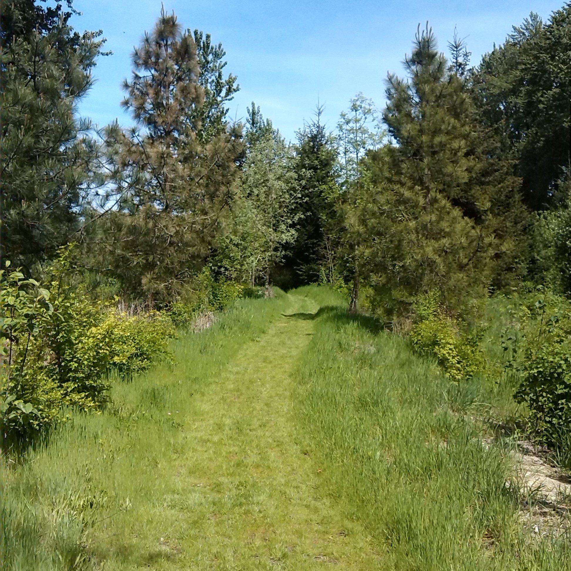
The North Trailhead gives you access to the Loop Trail. It’s roughly 3.3 miles of flat, easy walking, but the "easy" rating is a bit deceptive if it’s rained lately. In Oregon, that’s basically always. The mud here is legendary. It’s that thick, grey Willamette silt that wants to claim your boots.
Why bother? Because of the birds.
Specifically, the Western Meadowlark and the Streaked Horned Lark. These aren't just random birds; they are species that have been getting hammered by habitat loss for decades. At Luckiamute, the Oregon Parks and Recreation Department (OPRD), alongside the Luckiamute Watershed Council, has spent years ripping out invasive Armenian blackberry—everyone’s favorite thorny nightmare—and replanting thousands of native shrubs.
You’ll see it as you walk. One section is a dense gallery of Oregon Ash and Black Cottonwood. Then, suddenly, it opens up into a wide prairie. It’s weirdly quiet. You’re only a few miles from the small town of Albany or the campus of Western Oregon University, but the sound of the wind through the river-bottom forest makes it feel like 1850.
The Fight Against the Blackberry Wall
Let’s talk about the restoration because it’s honestly impressive. Before the state took over this land in the late 90s and early 2000s, it was a mix of fringe farmland and neglected woodlots. The invasive species had basically created a "green wall." You couldn't even see the river.
The OPRD didn't just mow it down. They went to war.
- They used controlled burns in some areas.
- Massive planting projects introduced Wapato and Camas back into the wetlands.
- They’ve worked to create "snags"—standing dead trees—to give woodpeckers and owls a place to live.
If you look closely at the younger groves of trees, you'll see blue tubes protecting the saplings. Those are there to keep the deer from snacking on the future of the forest. It’s a slow process. We're talking about a 50-year vision to return this to a pre-settlement state.
Navigating Luckiamute State Natural Area Without Getting Lost (or Stuck)
There are two distinct sections. They don't connect by a trail. You have to drive between them.
The North Unit is for the hikers and the birders. It’s where you’ll find the Paddy’s Marsh area. In the spring, the water levels rise and the marsh fills with waterfowl. It’s a prime spot for a pair of binoculars and a lot of patience.
The South Unit is much more focused on the river. This is the spot for the "Willamette Water Trail" users. If you’re paddling down the Willamette River, Luckiamute has a primitive paddle-in campsite. It’s basic. Don't expect a shower or a vending machine. It’s a clearing in the trees where you can pitch a tent and listen to the river move.
The Luckiamute River itself is a bit of a sleeper. It’s not as fast as the Santiam or as famous as the McKenzie. It’s a meandering, slow-moving silt-bed river. But it’s vital for Winter Steelhead and Chinook Salmon. They use the lower Luckiamute as a cold-water refuge when the main stem of the Willamette gets too warm in the summer.
What Most People Get Wrong About the "Natural Area" Label
A lot of folks show up expecting a "State Park" experience. They want picnic tables every twenty feet and maybe a paved path for a stroller.
Luckiamute isn't that.
The "Natural Area" designation means the priority is the ecosystem, not the visitor. There are no flush toilets. There is a vault toilet at the trailheads, and that’s about as fancy as it gets. There is no potable water. If you don't bring a bottle, you're going to be thirsty and sad.
Also, dogs must be on a leash. This isn't just a "law for the sake of laws" thing. This is a ground-nesting bird habitat. When a dog runs through the high grass in May or June, it can wipe out a whole generation of larks.
The Seasonal Reality of the Willamette Floodplain
You have to time your visit.
- Winter (December - March): Expect floods. The Willamette River frequently overspreads its banks here. The trails become part of the river. Check the OPRD website before you go, or you might find yourself looking at a lake where the parking lot should be.
- Spring (April - June): This is the peak. The wildflowers—specifically the Camas—start to pop. The birds are in full song. The mosquitoes are also waking up, and they are fierce.
- Summer (July - September): It gets hot. Real hot. The valley floor traps heat, and because much of the trail is through open prairie, there isn't much shade. Go early in the morning.
- Fall (October - November): The cottonwoods turn a brilliant gold. The air smells like decaying leaves and river silt. It’s arguably the best time for photography.
Real Talk: Is it worth the drive?
If you’re looking for a dramatic mountain vista, go to the Cascades. If you want a beach, go to Newport.
But if you want to see what the Willamette Valley looked like before it was turned into a grid of ryegrass fields and hazelnut orchards, Luckiamute is one of the few places left where you can see the "bones" of the landscape. It’s a place of subtle beauty. You have to look for the Western Painted Turtles sunning themselves on logs in the slough. You have to listen for the distinctive "rusty gate" sound of the Yellow-headed Blackbird.
It’s a place for people who like to get a little dirty and don't mind a bit of silence.
Actionable Tips for Your First Visit
- Download the Avenza Map: Cell service is spotty at best once you get down into the river bottom. Download an offline map of the Luckiamute State Natural Area before you leave Monmouth or Independence.
- Wear Waterproof Boots: Even in the "dry" season, the low-lying areas near the river confluence stay boggy. Don't wear your favorite white sneakers.
- Bring the Long Lens: If you’re a photographer, a 400mm or 600mm lens is your best friend here. The wildlife is abundant but shy.
- Check the River Gauge: Look at the USGS gauge for the Willamette River at Albany. If it’s above 15-18 feet, parts of the Luckiamute trails are likely underwater or extremely messy.
- Visit Both Units: Start at the North Unit for the hike, then drive the ten minutes around to the South Unit just to see the Luckiamute-Willamette confluence. It’s a powerful spot where two major water systems merge.
Don't expect to be blown away by a massive waterfall or a mountain peak. Instead, look for the way the light hits the gallery forest in the late afternoon. Notice the thickness of the moss on the Bigleaf Maples. Luckiamute isn't about the "grand gesture" of nature; it's about the quiet, persistent work of a landscape trying to heal itself.